|
|
 Motor
roads in western Canada, ca. 1928 Motor
roads in western Canada, ca. 1928 |
 Highways
map of the prairie provinces, 1931 Highways
map of the prairie provinces, 1931 |
|
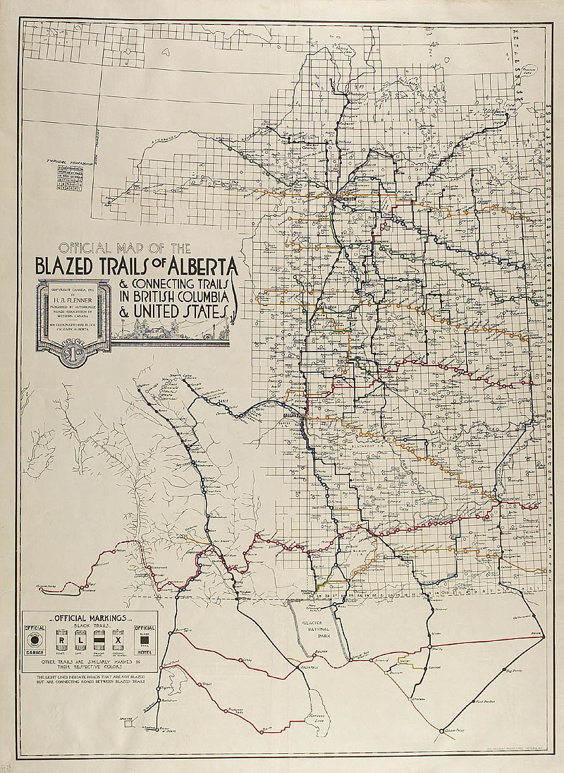
Early road map of Alberta
1922, by the Automobile Roads
Association of Western Canada
Encouraged by the promotion of western parks as vacation
wonderlands, a number of agencies began publishing maps
designed specifically for motorists, particularly American
motorists. The road map shown here was published in
1922 by the Automobile Roads Association of Western
Canada, a group that led a public crusade for improved
roads and signage. It is probably the earliest road
map of Alberta.
|