|
|
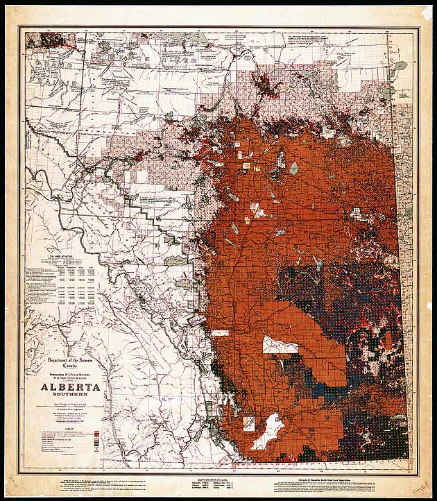
Map of southern Alberta showing
the disposition of homestead lands
1913
Before the introduction of the Dominion Lands Act,
western lands were held in common by First Nations.
In 1872, the Dominion Lands Act introduced the
concept of private land ownership and established procedures
by which land could be bought and sold like any other
commodity. This map shows the disposition status of
individual townships in southern Alberta up to 1913.
It also shows the extent to which the new Euro-Canadian
ideology had completely changed the nature of the western
landscape in only four decades.
|